Comparing RIEGL miniVUX-1UAV and RIEGL miniVUX-3UAV: Key Differences & Features
RIEGL miniVUX-1UAV vs. miniVUX-3UAV: Which LiDAR Sensor is Best for Your UAV Mapping Needs?
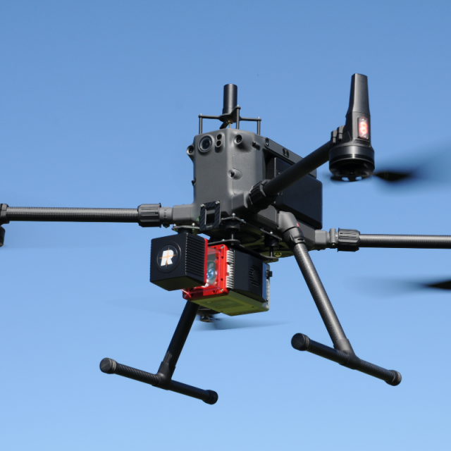
When it comes to high-precision LiDAR scanning for UAV-based applications, RIEGL is a trusted name in the industry. Their miniVUX series offers lightweight, compact, and powerful LiDAR solutions designed for UAV (drone) integration. Two of the most popular models in this lineup are the miniVUX-1UAV and miniVUX-3UAV.
Both are exceptional laser scanners with high-performance capabilities, but they cater to slightly different use cases. So, which one is right for your UAV surveying needs? Let's dive into a side-by-side comparison to help you make the best decision.
RIEGL miniVUX-1UAV: Reliable, Lightweight, and Cost-Effective
The RIEGL miniVUX-1UAV is a highly versatile and lightweight LiDAR scanner designed specifically for UAV-based mapping and surveying. Its 360-degree field of view, accurate distance measurements, and compact design make it ideal for drone-mounted applications in various industries.
Practical Use Cases for the miniVUX-1UAV
- Forestry & Vegetation Analysis: A research team uses the miniVUX-1UAV to penetrate dense vegetation and generate precise canopy height models. The scanner’s capability to detect ground surfaces beneath thick tree cover makes it invaluable for ecological studies.
- Agriculture & Land Management: Farmers utilize the miniVUX-1UAV to analyze crop health, measure terrain elevation, and optimize irrigation strategies based on detailed 3D data.
- Infrastructure & Powerline Inspection: Utility companies deploy the miniVUX-1UAV to inspect power lines, detect potential obstructions, and assess pole heights efficiently.
- Topographic & Terrain Mapping: Surveyors use this LiDAR scanner to generate detailed digital terrain models (DTMs) and digital elevation models (DEMs) for geospatial applications.
With its 100 kHz pulse repetition rate and high-precision point cloud generation, the miniVUX-1UAV is a cost-effective solution for UAV-based mapping that doesn’t compromise on quality.
RIEGL miniVUX-3UAV: Higher Speed, Increased Point Density, and Enhanced Performance
The RIEGL miniVUX-3UAV builds upon the capabilities of the miniVUX-1UAV, offering a significantly higher pulse repetition rate of 300 kHz, which results in denser point clouds and greater detail. It is perfect for applications requiring higher resolution and faster data acquisition.
Practical Use Cases for the miniVUX-3UAV
- Urban Planning & Smart City Development: A city planning team uses the miniVUX-3UAV to capture high-resolution 3D models of buildings, roads, and infrastructure to improve city layouts.
- Archaeology & Cultural Heritage Documentation: Archaeologists utilize the miniVUX-3UAV to scan ancient ruins and historical sites with extreme detail, ensuring accurate preservation and digital reconstruction.
- Mining & Quarrying: Engineers employ the miniVUX-3UAV for volume calculations and excavation planning, allowing for efficient resource management and safety assessments.
- Coastal & Floodplain Mapping: Government agencies use this scanner for coastal erosion monitoring, flood risk analysis, and shoreline mapping to support environmental conservation efforts.
With its higher pulse rate and increased scanning capability, the miniVUX-3UAV is the go-to choice for professionals needing more detailed data and faster acquisition times.
Side-by-Side Comparison
| Feature | RIEGL miniVUX-1UAV | RIEGL miniVUX-3UAV |
|---|---|---|
| Pulse Repetition Rate | 100 kHz | 300 kHz |
| Max Measurement Rate | 100,000 meas./sec | 300,000 meas./sec |
| Point Density | Moderate | High |
| Scanning Range | Up to 330m | Up to 330m |
| Field of View (FoV) | 360° | 360° |
| Weight | ~1.55 kg (3.4 lbs) | ~1.55 kg (3.4 lbs) |
| Power Consumption | Low | Slightly higher |
| Ideal Applications | Forestry, agriculture, powerline inspection, terrain mapping | Urban mapping, archaeology, mining, high-detail infrastructure surveys |
| Best For | Cost-effective UAV LiDAR scanning with solid accuracy | High-speed, high-resolution LiDAR scanning with increased point density |
Which One Should You Choose?
Choosing between the miniVUX-1UAV and miniVUX-3UAV depends on your data requirements, project complexity, and budget.
- Choose the miniVUX-1UAV if you need a lightweight, reliable, and cost-effective LiDAR sensor that delivers accurate scans for general UAV mapping applications such as forestry, agriculture, and infrastructure inspection.
- Choose the miniVUX-3UAV if you need higher point density and faster data acquisition, especially for urban planning, archaeology, mining, and high-resolution infrastructure surveys.
Both sensors integrate seamlessly with various UAV platforms and RIEGL’s powerful processing software, making them excellent choices for professionals in the geospatial industry.
Final Thoughts
Imagine you’re an environmental scientist surveying a dense forest—the miniVUX-1UAV allows you to accurately map the terrain beneath thick vegetation, helping in conservation planning. Alternatively, if you’re a city planner working on a digital twin of an entire urban area, the miniVUX-3UAV provides incredibly detailed 3D models with higher-resolution data to aid in smarter infrastructure development.
Whether you need cost-effective, dependable LiDAR scanning or high-speed, high-detail UAV-based mapping, RIEGL has a top-tier solution tailored to your needs.
Ready to take your UAV LiDAR capabilities to the next level?
Explore our selection of RIEGL miniVUX scanners today and find the perfect match for your next project!